Overview of Hot Springs Canyon:
Maps and Sub-areas
Below, an overview of the canyon from its sources in the Galiuro and Winchester Mountains (the upper-right-hand quadrant of the image) to its confluence with the San Pedro River at Cascabel (far left in the lower-left quadrant of the image). This map does not include the higher reaches of the two mountain ranges, where the ultimate sources of Hot Springs Canyon waters lie, though these areas are of course very important parts of the whole drainage.
Click on the image for a larger view.
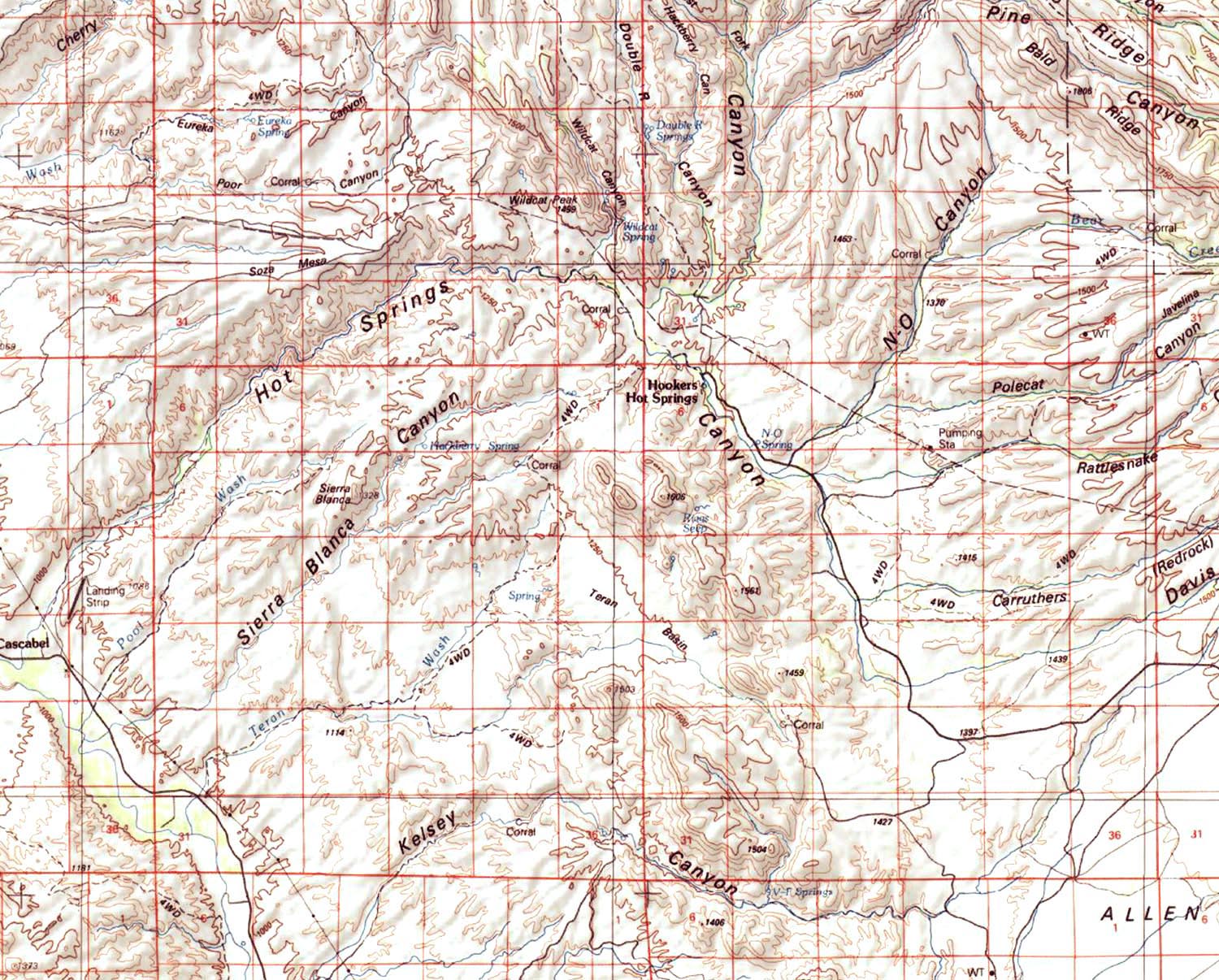
The Allen Flat at lower right above lies outside the Hot Springs Canyon drainage, as do the washes running out of Soza Mesa into Cherry Canyon at far upper-left. Allen Flat drains through Kelsey Canyon, as shown here, and through the Tres Alamos Wash which is mostly out of view.
For our purposes (Saguaro Juniper Corporation), we divide Hot Springs Canyon into three sub-areas: Lower, Upper, and "Hooker's", as indicated on the map below. We are using these divisions partly for historical-environmental reasons (the division between Lower and Upper (as we have designated it for a number of years now) marks the boundary of the Yellow Cliffs (see further below), where significant vegetation changes occur, and partly because the Bureau of Reclamation is now proposing to construct a fish barrier at the northeast corner of what we call the "Big Bend". This will divide the canyon definitively at this location. Instead of reconfiguring a division among Lower, Middle, and Upper parts of the canyon (which would cause us great inconvenience in reconstituting our web pages), we choose to name this further-upstream portion after the name of the original owner of the headquarters of the Muleshoe Preserve, hence "Hooker's".
Click on the image for a close-up view of the divisions.

As shown in the map below, The Lower Hot Springs Canyon portion runs from Cascabel past the Windmill and Rabbit Ears Saguaro Hill To the Yellow Cliffs as shown on the map below. Upper Hot Springs Csnyon runs from the Yellow Cliffs past the Red Trail, through the Narrows to the Zig-zag Bend and on to the Big Bend, where it ends at the fish barrier site.
